
Ha Long Bay
Vietnam
See the map
General Information
about Ha Long Bay
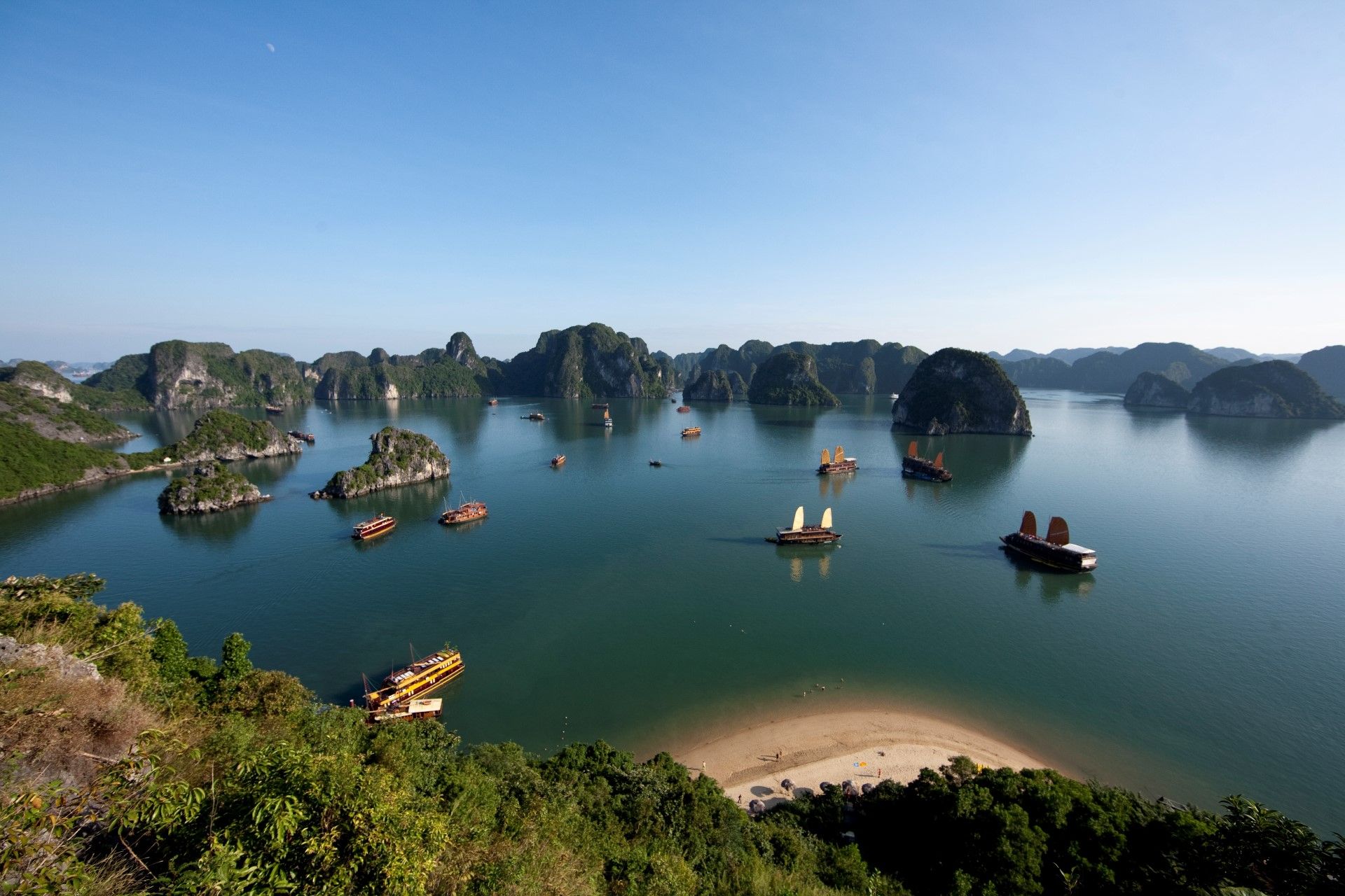
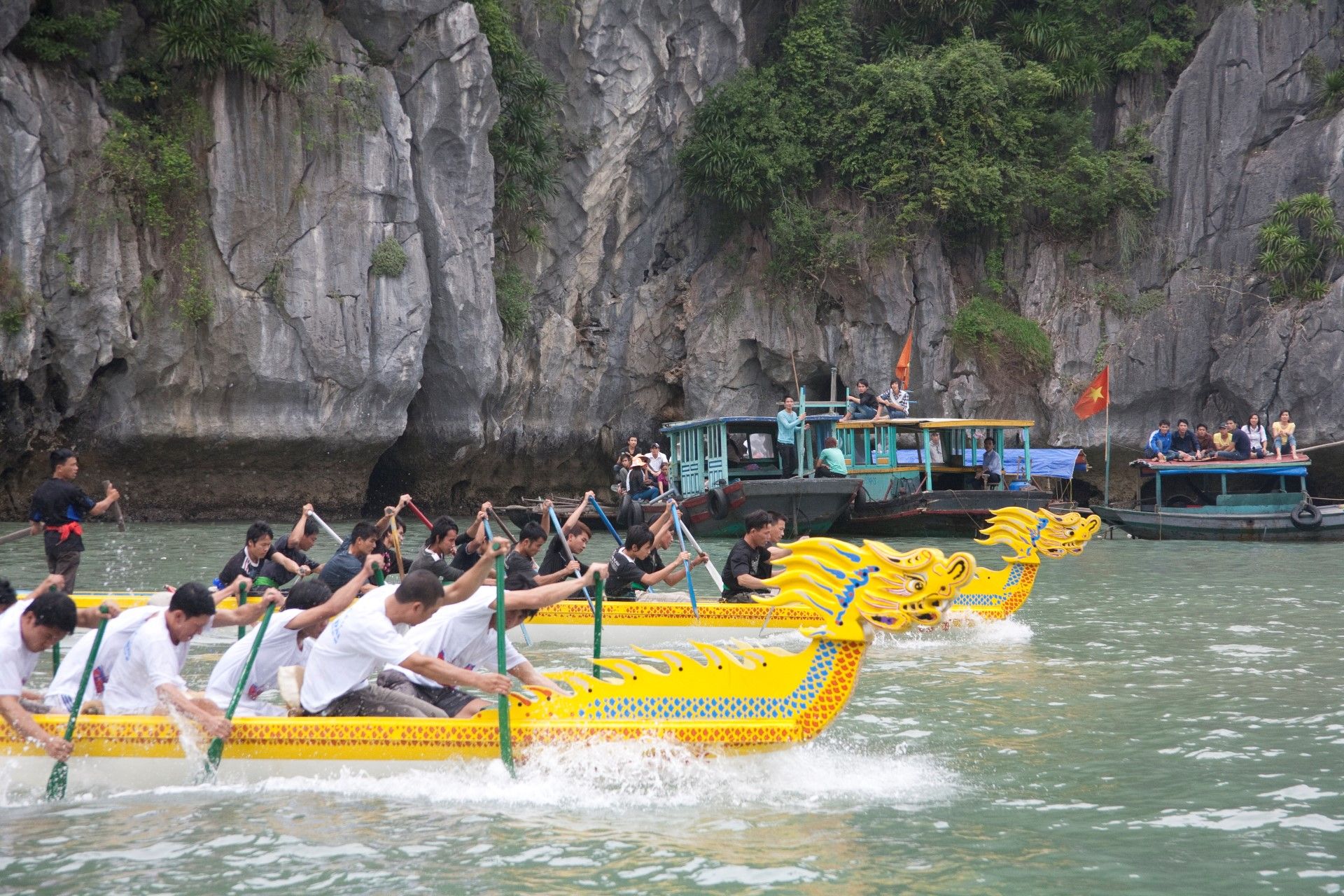
Hạ Long Bay (meaning in Vietnamese “descending dragon bay”) is a UNESCO World Heritage Site and popular travel destination in QuảngNinh Province, Vietnam.
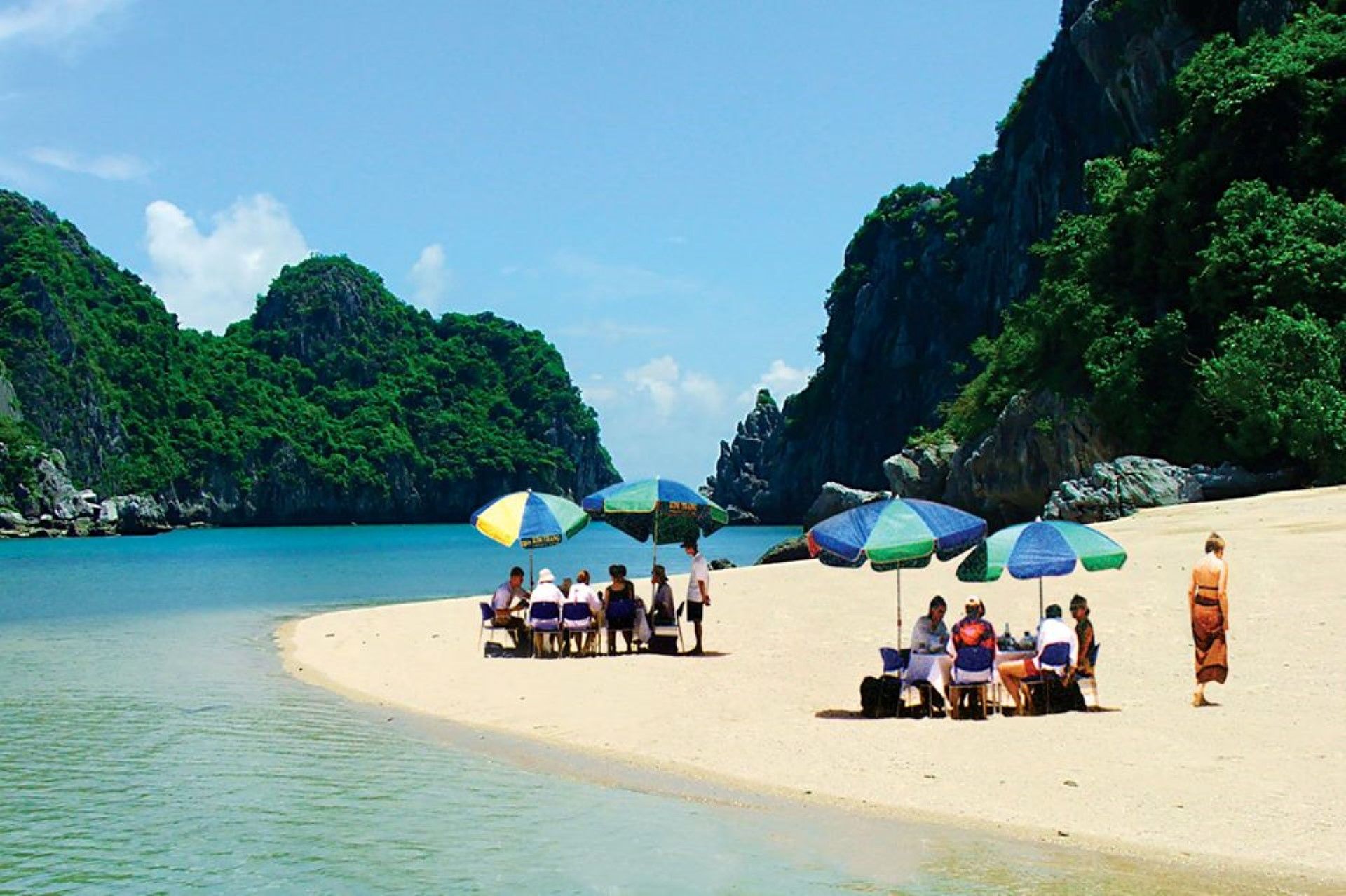
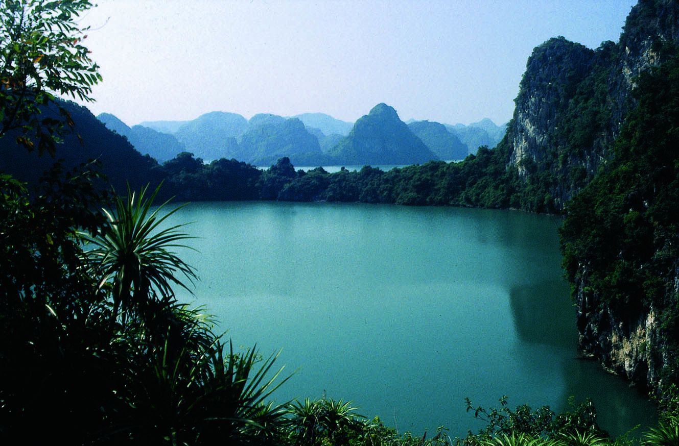
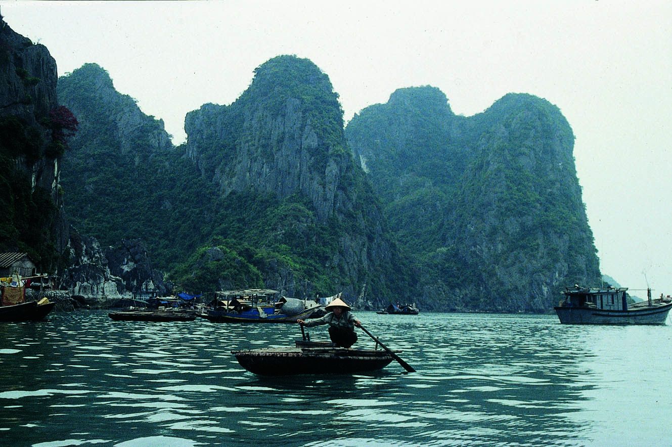
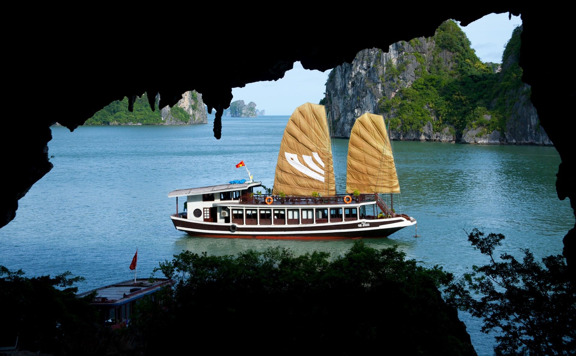
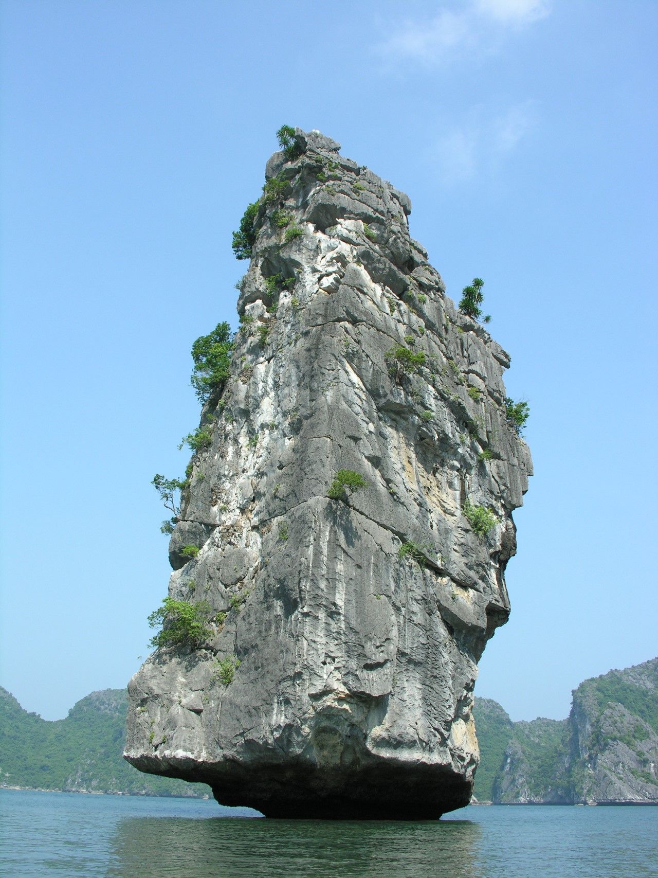
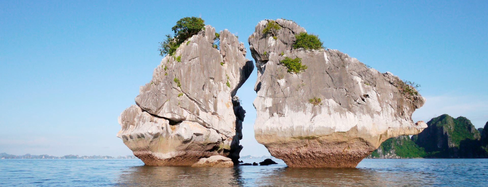
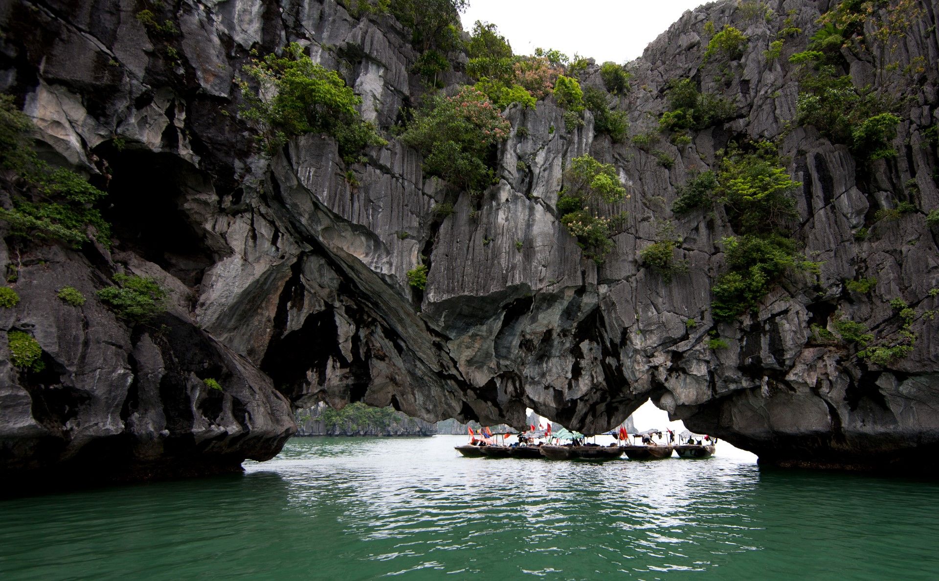
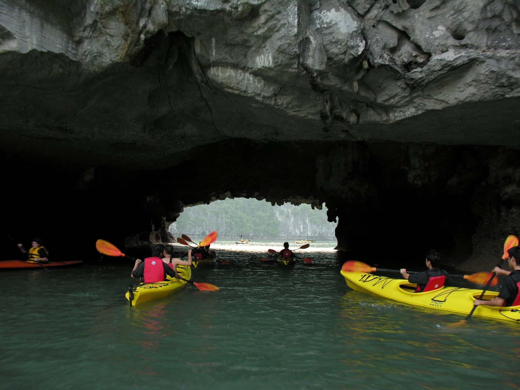
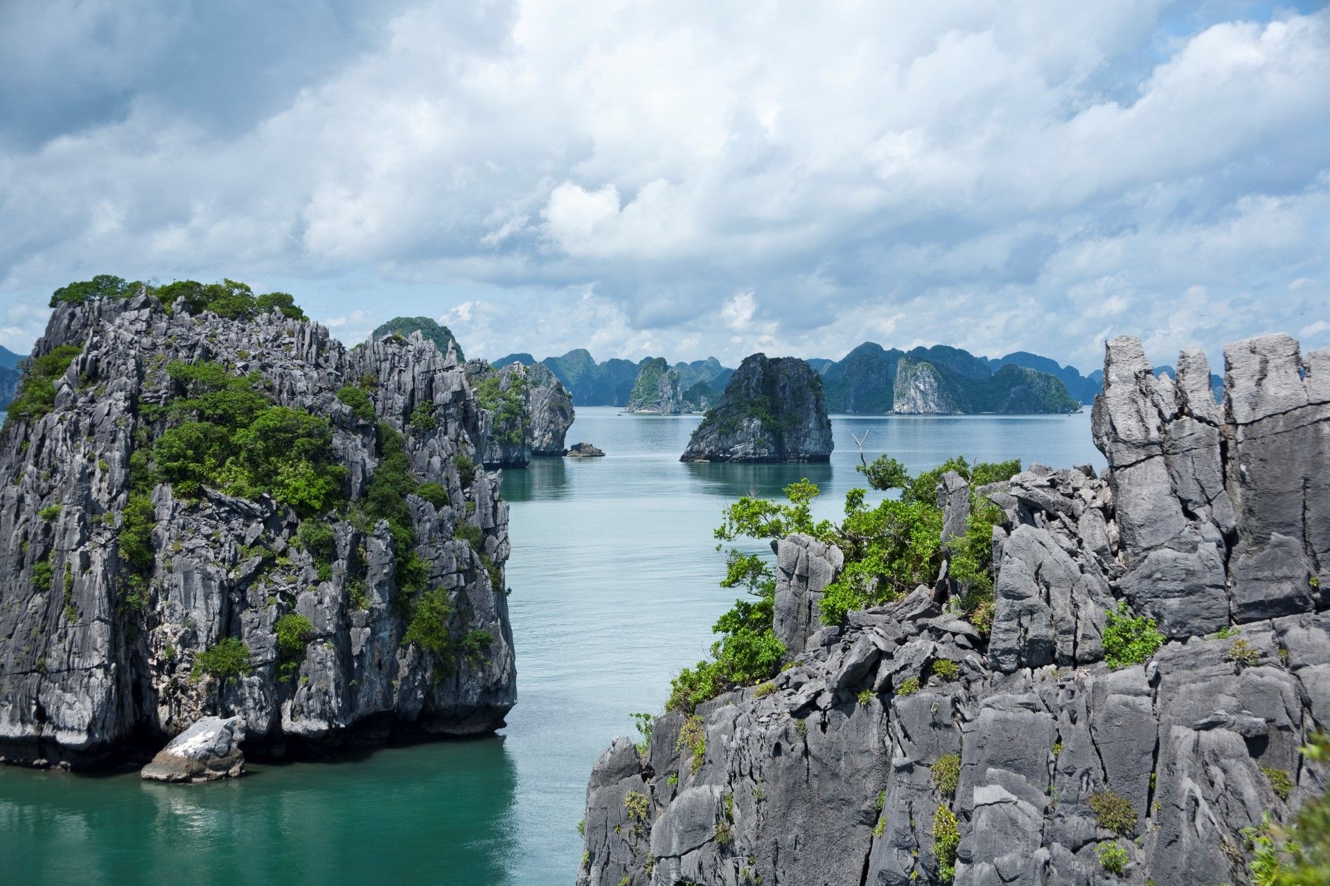
The bay features thousands of limestone karsts and isles in various shapes and sizes. Hạ Long Bay is the centre of a larger zone which includes BáiTử Long Bay to the northeast, and CátBà Island to the southwest. These larger zones share similar geological, geographical, geomorphologic, climate and cultural characteristics.
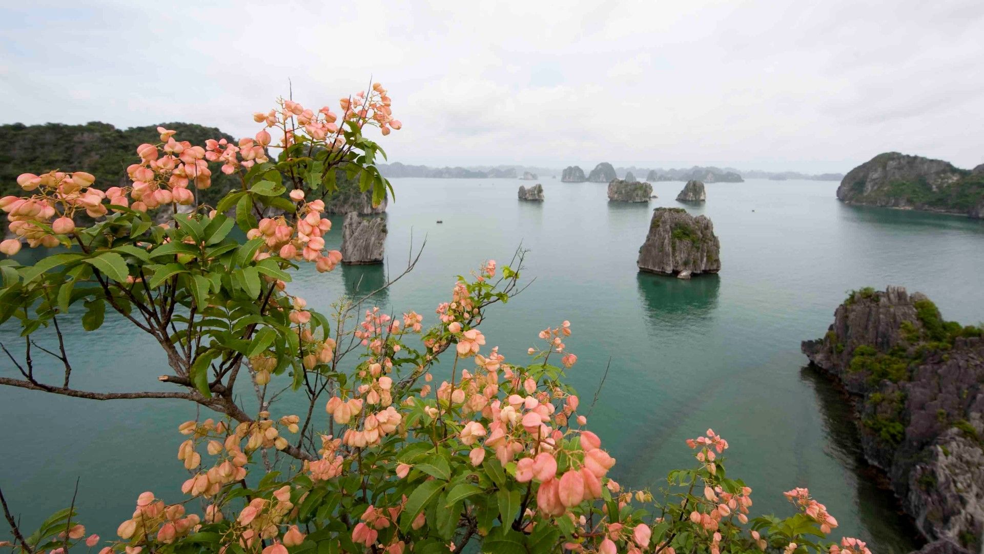
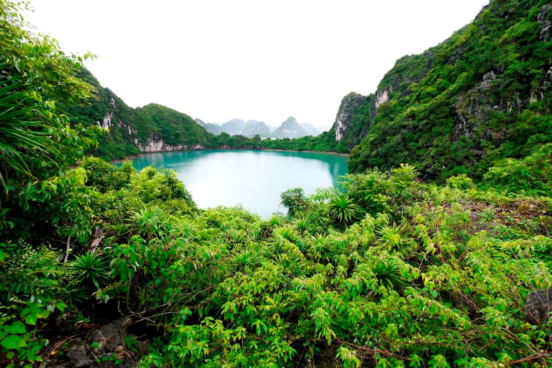
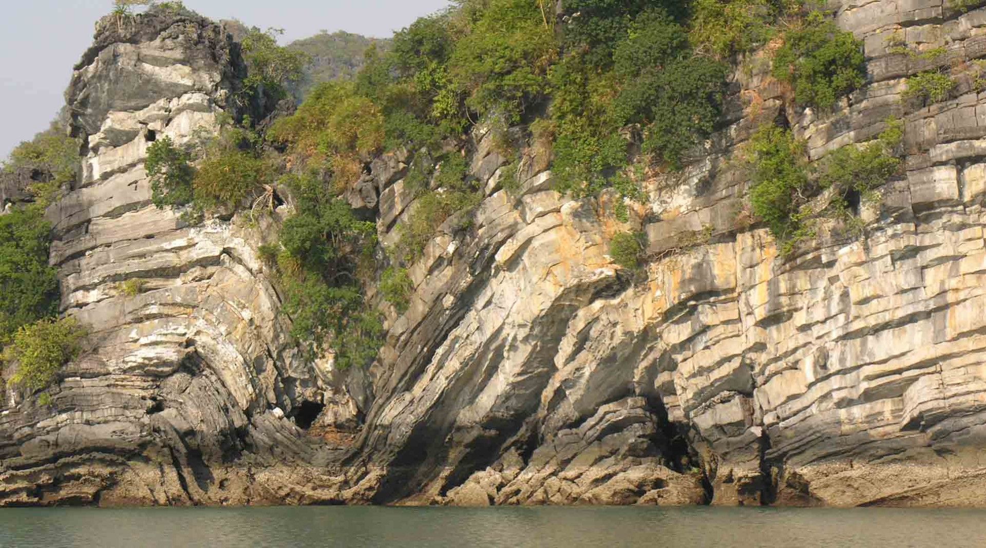
Hạ Long Bay has an area of around 1,553 km², including 1,960–2,000 islets, most of which are limestone. The core of the bay has an area of 334 km² with a high density of 775 islets. The limestone in this bay has gone through 500 million years of formation in different conditions and environments. The evolution of the karst in this bay has taken 20 million years under the impact of the tropical wet climate. The geodiversity of the environment in the area has created biodiversity, including a tropical evergreen, oceanic and seashorebio system. Hạ Long Bay is home to 14 endemic floral species and 60 endemic fauna species.
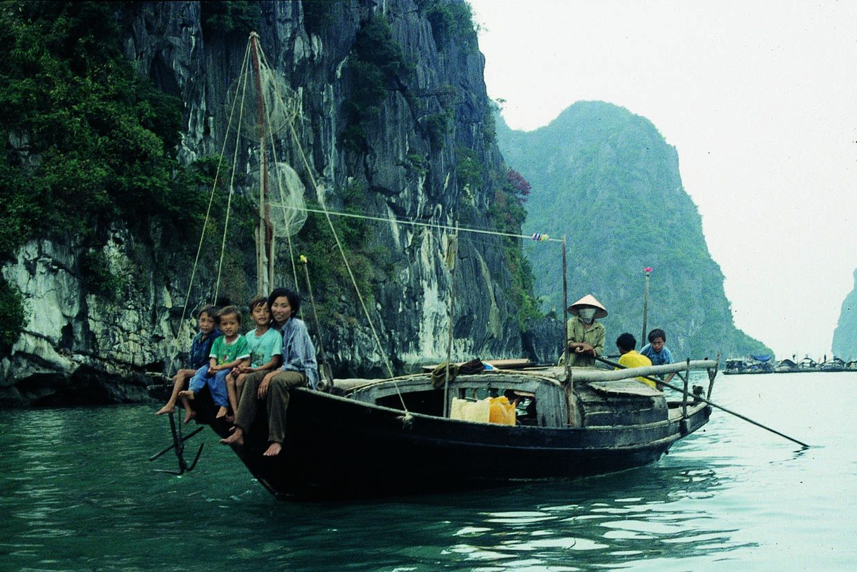
Historical research surveys have shown the presence of prehistorical human presence in this area tens of thousands of years ago. The successive ancient cultures include the SoiNhụ culture around 18,000–7000 BC, the CáiBèo culture 7000–5000 BC and the Hạ Long culture 5,000–3,500 years ago. Hạ Long Bay also marked important events in the history of Vietnam with many artifacts found in BàiThơ Mount, ĐầuGỗ Cave, BãiCháy.
Five hundred years ago, NguyễnTrãi praised the beauty of Hạ Long Bay in his verse LộnhậpVânĐồn, in which he called it “rock wonder in the sky.” In 1962, the Ministry of Culture, Sports and Tourism of North Vietnam listed Hạ Long Bay in the National Relics and Landscapes publication. In 1994, the core zone of Hạ Long Bay was listed by UNESCO as a World Heritage Site according to criterion vii, and listed for a second time according to criterion viii.
La baie d’Hạ Long (signifiant en vietnamien « descendant la baie du dragon ») est un site classé au patrimoine mondial de l’UNESCO et une destination de voyage populaire de la province de Quảng Ninh, au Vietnam.
Les milliers d’îlots et d’îles karstiques de différentes formes et tailles sont la particularité de cette baie. La baie d’Hạ Long se trouve au centre d’une zone plus vaste, comprenant la baie de BáiTử Long, au nord-est, et l’île CátBà, au sud-ouest. Ces zones plus vastes partagent des caractéristiques géologiques, géographiques, géomorphologiques, climatiques et culturelles similaires.
La baie d’Hạ Long a une étendue d’environ 1 553 km², dont 1 960 – 2 000 îlots, la plupart en calcaire. Le cœur de la baie a une superficie de 334 km² et une forte densité de 775 îlots. Le calcaire de cette baie s’est formé au long de 500 millions d’années, dans des conditions et des environnements différents. Dans cette baie, le karst s’est développé au long de 20 millions d’années sous l’impact du climat tropical humide. La géo-diversité de l’environnement dans la région a créé une biodiversité y compris un système biologique tropical à feuilles persistantes, océanique et côtier. La baie d’Hạ Long abrite 14 espèces florales et 60 espèces fauniques endémiques.
Des études historiques ont révélé une présence humaine préhistorique dans cette région il y a des dizaines de milliers d’années. Les anciennes cultures successives sont la culture Soi Nhụ autour de 18 000-7000 av. J.-C., la culture CáiBèo 7000-5000 av. J.-C. et la culture Hạ Long 5 000-3 500 ans. La baie d’Hạ Long a également vécu des événements importants dans l’histoire du Vietnam, de nombreux artefacts ayant été trouvés dans le mont BàiThơ, la grotte de ĐầuGỗ, BãiCháy.
Il y a 500 ans, NguyễnTrãi louait la beauté de la baie d’Hạ Long dans son verset LộnhậpVânĐồn, dans lequel il l’appelait « merveille de la roche dans le ciel ». En 1962, le ministère de la Culture, des sports et du tourisme du Vietnam du Nord a inscrit la baie d’Hạ Long dans la publication National Relics and Landscapes. En 1994, la zone centrale de la baie d’Hạ Long est inscrite par l’UNESCO au patrimoine mondial selon le critère vii, puis elle est inscrite une deuxième fois selon le critère viii.
Local Partners: www.halongbay-vietnam.com
Natural Environment
Coastline
Cliffs limestones (Karst) a number of islands
Climate
Hot climate at dry winter
Temperatures
Annual average : 22, 5° C
Thermal amplitude : between 12° C and 32° C
Precipitations
Annual : 2500 mm
Distribution : Rains of monsoon of summer
Biogeographic Classification
---
Human Environment
Language
Vietnamien
Local Economy
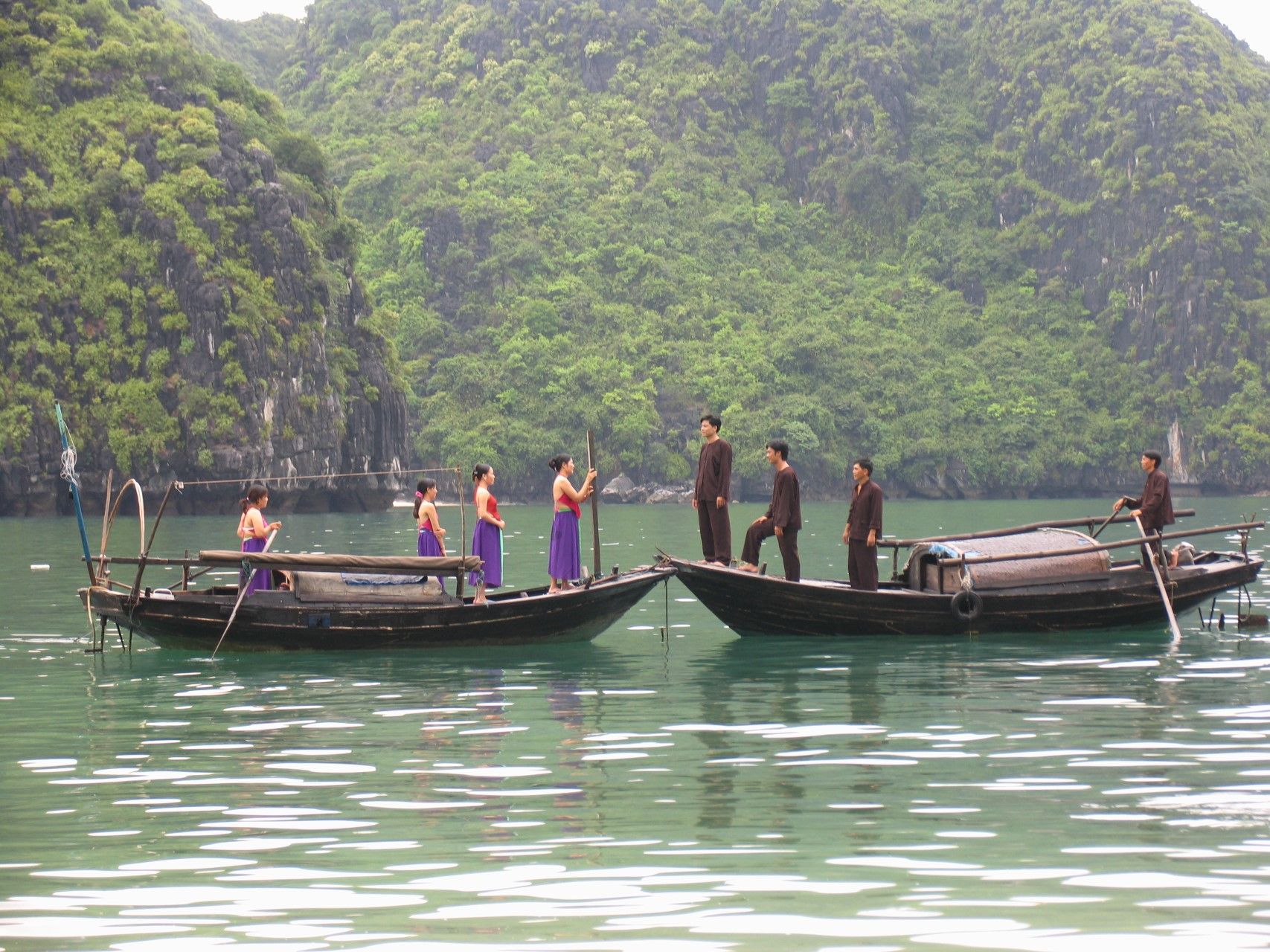
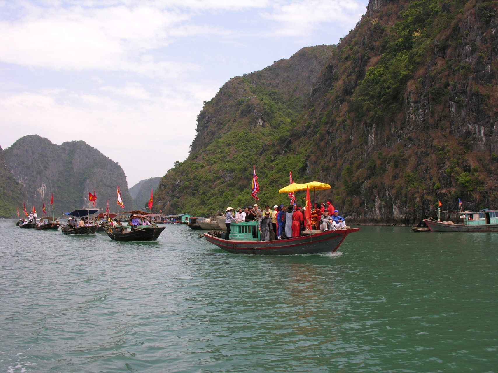
Maritime transport - Tourism - Fishing - fish breeding - Agriculture
Demography
Population (inhab.) : 200 000
Density (inhab/km2) : 300
Human Development Index
Vietnam : 0, 688
Ecological Footprint
0,76
Heritage and Credentials
Natural Heritage
Criterion III : 'There is a diverse flora throughout Ha Long, and primary tropical forest is found, mostly on the islands of Ba Mun and Cat Ba...' 'results from preliminery surveys indicate the presence of about 1 000 fish species. Mammals, reptiles and birds are found on the islands, especially the earth type'.
Cultural Heritage
'Numerous archaeological sites have been found and at Giap Khau (Hon Gai) there is evidence to suggest occupation by the Hoa Binh Culture, some 10 000 years ago present...' 'During prehistoric times, Ha Long was a significant port, located on the trade routes between China, Japan, and other countries in South East Asia.
Coastal Management
The Ministry of Culture, Information and Sports.
Criteria retained by the club
BN 1 : geological process (islands and grottos) ; BC 5 : Traditional occupations.
Latest news
about Ha Long Bay
 your business playground